PoliVisu Online Course on Policy Making Through Data & Visualisations
Basic Information
Language
English
Latest update
Price
Free
Application time
5 hours
Tool type
Other
Application area
- Analysis, scenarios and measure selection
- Appraisal and assessment
- Evaluation and monitoring
- Dissemination and communication
Target Audience
- Small cities
- Medium-sized cities
- Large cities
- Metropolitan regions
Summary
This free online course is developed by the European project PoliVisu to promote the use of advanced visualisations in policy making. Focusing on urban mobility as an important subfield within transportation, the course provides a holistic view of data visualisations and their role at different stages of the policy process.
The course draws on multiple disciplines, learning formats and best practices to offer content that is both engaging and insightful for a wide range of audiences 1) public sector staff who either work with data directly (analysts, data officers etc.) or depend on it to make informed decisions; social scientists, journalists, civil society groups, university students, GIS specialists, traffic engineers, web developers, Open Source enthusiasts.
The course is published all-at-once, meaning there will be no gradual releases over time. Learners are encouraged to follow the course at their own pace, taking as much time as they need. Individuals who complete all the required assignments will receive a free 'Statement of Participation' at the end.
The course is organised around three main modules preceded by an introduction. Each module is made up of three chapters and ends with a quiz.
Learners must view all pages and attempt all activities (forums, quizzes) in order to achieve 100% completion, at which point the certificate will be sent to their email.
Good Example
The tool itself was published recently (July 2020) and so far 57 people enrolled in the course. More time is needed to assess its true impact. That said, the course includes many best practice examples from European cities that piloted the PoliVisu framework during the project. For instance:
- Issy-les-Moulineaux: The city obtained traffic data that it previously didn’t have. This data was then used to build the Issy Mobility Dashboard, which enabled local policy makers to assess the impact of roadworks on local traffic conditions.
- Gent: The city obtained proxy data on student locations that was later used to inform planning decisions e.g. where to build student residences?
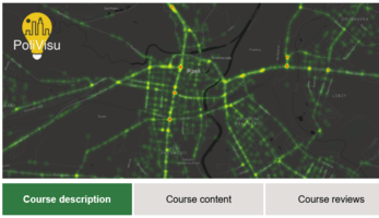
- Pilsen: The city harnessed big data from traffic detectors and is now using this information to plan and evaluate traffic policy measures e.g. should the city build a new tram line to university campus? Should a street be converted into a pedestrian zone?
Contacts
PoliVisu
info [at] polivisu.eu


