Progress

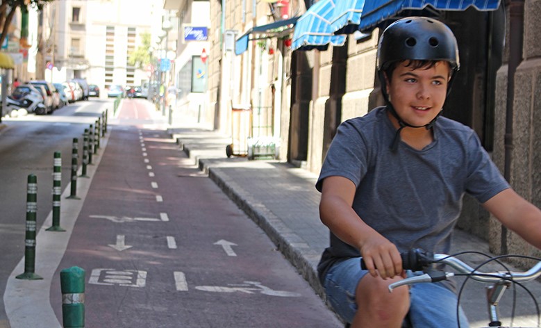
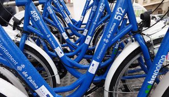
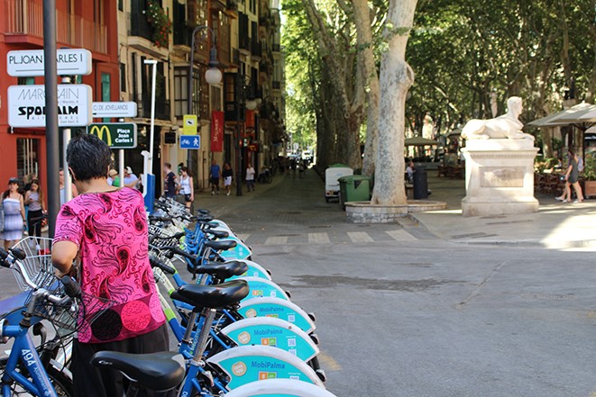
A mobility survey conducted in 2009 indicated that cycling and walking together account for 38% of the trips within the city of Palma. The share of cycling was still too low to be measured separately. Since 2007, 17.5 kilometres of cycling lanes have been established, bringing the total length of cycling lanes to 43.5 kilometres at the beginning of 2011. A new public bicycle service was implemented in the city in April 2011 with 300 bicycles.
Car access has been restricted in the historic city centre since the 1990s. In 2009, the original barriers were replaced by a video camera system equipped with licence plate recognition software. Walking is the main means of transport in the historic city centre. In 2011, the Palma conducted an inventory of physical barriers in public spaces and public buildings for older people and disabled citizens in order to advance the city's accessibility plan. It also created pedestrian areas in the historic city centre as well as beside two routes towards the city centre.
Planning & preparation
During the preparation phase of the CIVITAS measure the following tasks were carried out within the framework of the SUMP development:
- Study on location of new stands for public bikes and market study on expansion of number of bicycles
- Citizen (residents and businesses, public medical sector, old people associations, disabled people associations) participation events and tools for the first two healthy walking routes and the new cycling connections, including:
- a kick-off event in the area of each of the two healthy walking routes to discuss ideas with stakeholders
- Up to 5 information events to show the basic design options of healthy walking routes and cycling lanes
- Design and planning of new cycling routes
- Design and planning of two healthy walking routes (safe routes)
Implementation & demonstration
In the implementation phase the following tasks were executed:
- Two healthy walking routes in the areas of the health centres, Son Gotleu and Valldargent, have been inaugurated. The city has manipulated public spaces and traffic lights to make the routes more accessible for people with reduced mobility.
- Seven safe routes to school have been established with small changes in infrastructure to increase safety for walking and cycling.
- 150 new bicycles and 175 new anchor points have been added to the public bike system, BiciPalma. Nine new BiciPalma stations were introduced to cover more neighborhoods. The system was opened to visitors and tourists.
- Second extension is taking place with 100 additional bikes, 100 anchor points and 5 new stations
- Over 16 kilometres of new cycling lanes were developed during the project, already tripling the original objective.

Outcomes
Tangible outputs:
- 2 idea-generating events for healthy walking routes with stakeholders
- 5 information events on the new infrastructures for slow modes
- Expansion of public bike system with 150 new bicycles and 175 new anchor points
- 16 kilometres of cycling lanes
- Two healthy and safe accessible walking routes
- Development of 7 safety paths to school
- 2 Promotion campaigns (one on walking and one cycling)
- Private car restriction in the historic center and 30 km/h limit in all the area.
Expected outcomes in the short- to medium-term:
- Increased number of cyclists in the CIVITAS area by 20%
- Increased share of walking trips by 20%
- Increase in the number of uses of the public bike system
Expected outcomes in the mid- to long-term:
- Reduced congestion
- Reduced emissions in the city centre
- Increase in cycling trips for personal and business purposes